
Lewis Smith reservoir is a 35 mi long, 21,200 acre impoundment located in the headwaters of the Black Warrior River, on Sipsey Fork and Brushy Creek in north central Alabama. The dam was constructed in 1962 and is operated by the Alabama Power Company to provide flood control and hydroelectric power. Water levels upstream of the reservoir fluctuate seasonally and are generally highest in the spring and lowest in late fall or early winter. Seasonal water level fluctuations can be up to 20 ft. and create a ‘transition zone’ at the upstream extent of the impoundment. During high water periods the lower reaches of Sipsey Fork and Brushy Creek and their tributaries become inundated by reservoir water, which eliminates riverine habitat and isolates and fragments aquatic communities. As lake levels drop and tributaries reconnect to mainstem rivers, aquatic communities at least temporarily regain lost habitat and become less isolated. The frequency, timing, and magnitude of changes in water levels have the potential to affect stream habitat and the distribution and ultimately the persistence of aquatic species within the Sipsey Fork and Brushy Creek watersheds, but the spatial and temporal extent of the transition zone and its effects on aquatics and habitat are largely unknown.
In 2012, the Bankhead National Forest initiated a multi-year effort to investigate the effects of the transition zone on biota (fish, mussels, crayfish, salamanders, turtles, and aquatic plants) and habitat within the Sipsey Fork and Brushy Creek watersheds.

The Sipsey Fork and Brushy Creek drainages on the Bankhead NF are home to 4 federally listed mussels (2 endangered and 2 threatened), 4 sensitive mussels, 1 threatened turtle, 2 threatened aquatic plants, 3 sensitive fish, and 1 sensitive salamander along with 94 mi of designated critical habitat for mussels. In cooperation with the Alabama Natural Heritage Program, the Geological Survey of Alabama, the USFS Southern Research Station, the Center for Aquatic Technology Transfer, and the Alabama Power Company (APCO), the Bankhead National Forest’s goals for this multi-year effort are to delineate the extent of the transition zones in Sipsey Fork and Brushy Creek, determine distribution and status of biota in the transition zones, provide a baseline for long-term monitoring, and develop streamside management plans.
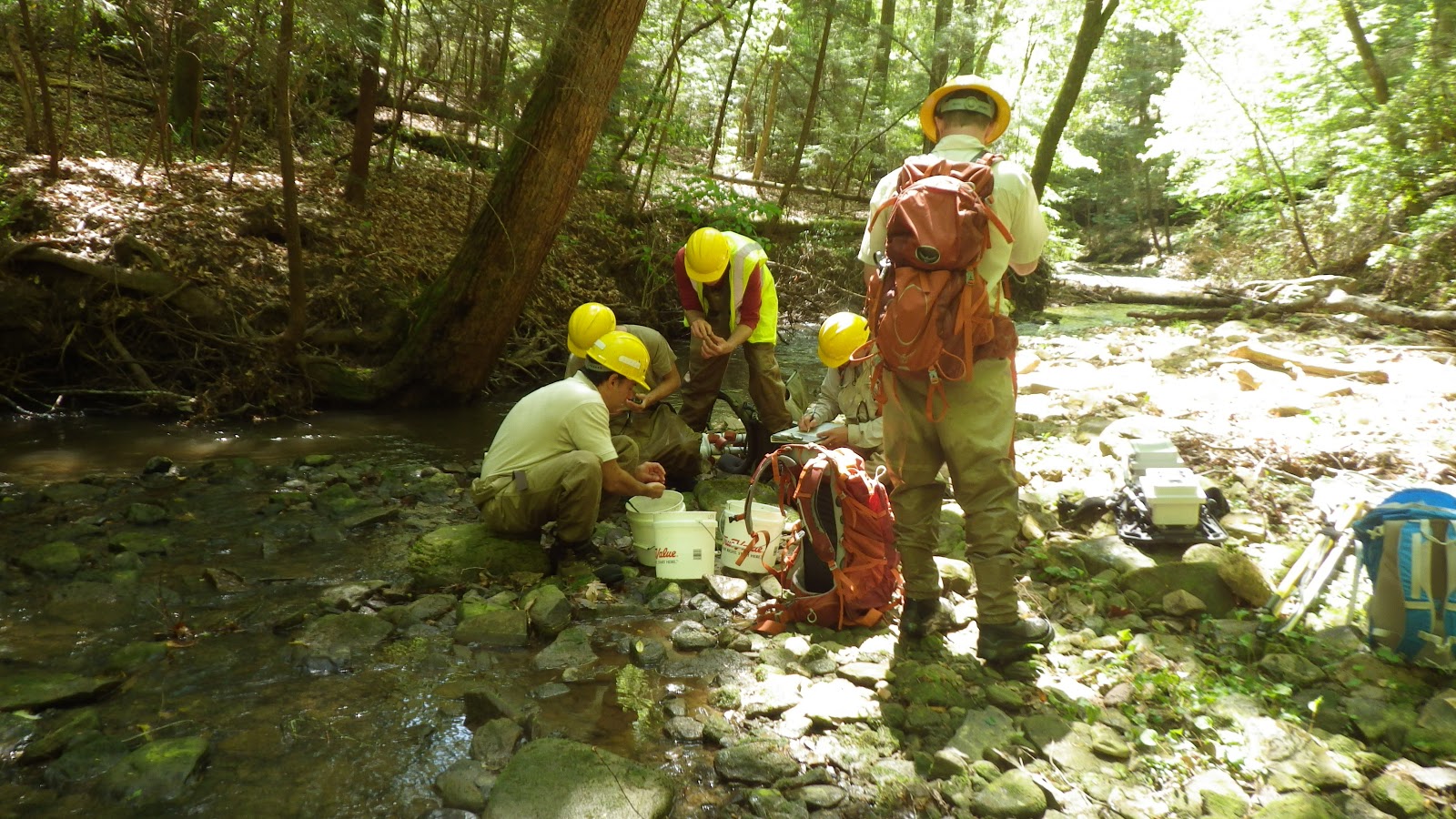
The project continues this year. Fisheries biologists from the Forest Service’s Southern Research Station in Blacksburg, Virginia and Oxford, Mississippi sampled fish in the main stem Sipsey Fork and Brushy Creek and tributaries inundated by the reservoir water. Spring fish sampling methods included backpack electrofishing in small streams, boat electrofishing in main stems, and the use of a mini-trawl in main stems and mouths of major tributaries.

The project was made possible by an agreement with APCO and the NFs in Alabama.
No comments:
Post a Comment